Walk Length and Type
A Linear Walk as part of the Radstock Ring. 5.8mls/9.4kms
Description of Walk
This linear walk as part of the Radstock Ring starts at Mells Playing Fields and takes you into the village and through the church yard of St. Andrews and onto the pretty Mells stream through Wadbury valley. On reaching Great Elm you continue along the river valley before making your way across field footpaths to Buckland Dinham and then follow part of the long distance Macmillan Way footpath onto the beautiful village of Lullington.
Description of Area
It is hard to imagine when seeing the historic village of Mells that it was once surrounded by coal mines and along the Mells stream valley there was the factory of James Fussell Iron Works which employed over 500 workers. Mells Manor was once owned by the Horner Family but is now owned by Earl Oxford and Asquith. The nearby former railway is now the route of National Cycle Route 24, The Colliers Way.
Buckland Dinham is another interesting village, the church St. Michael and All Angels dates back to 1200 and it has been designated as a Grade I listed building. Agriculture is the main occupation in this area as you make your way to Lullington passing by Orchardleigh House and across Orchardleigh Golf Course.
The Basics
Distance in miles and km: 5.8mls/9.4kms
Gradient: Undulating
Severity: Moderate
Approx min time to walk : 3hrs
Stiles: Several
Maps: OS Map 142
Path description: Riverside paths, tracks, and field paths
Dog Friendly: Yes
Public Toilets: None
Nearest Refreshments: Mells Village Cafe, Talbot Inn Mells, Bell Inn Buckland Dinham
Public Transport: Check timetable and availability with http://www.travelinesw.com
Start Point: Mells Village Car Park,Longfield,BA11 3PY
Parking: Mells Village Car Park,Longfield,BA11 3PY
Map
Download route: 
Walk Route
[1]From the village car park in Mells follow the footpath sign into the recreation field and walk across the edge of the field to the wooden gate in the left corner. Go through the gate and walk along the driveway to the road. Cross the road and turn left to the junction with the main street. Turn right passing the entrance of Mells Manor and the Talbot Inn and then immediately turn left up an old street passing the old school on the right and enter the churchyard. Walk around to the right and enter an avenue of clipped yews and exit through gate.
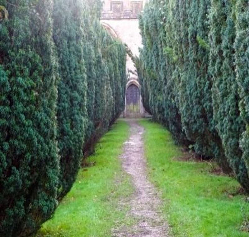
[2]Turn right and walk through the avenue of trees to the kissing gate and road. Walk ahead to T junction and go straight across into field. Walk around right hand edge of field to find stone stile leading to road in bottom right hand corner. Exit with care and cross busy road and turn left and almost immediately turn right through gateway marked Mells Estate.
[3]The path (about one mile long)takes you along the Mells Stream and through the beautiful Wadbury Valley. Large buildings appear in front of you and these are the remains of Fussell's ironworks. The footpath goes to the left of the derelict buildings and continue along until you meet a tarmac drive. Walk ahead and partway along the drive take the footpath entrance on the right between a hedge (signed "Wyvern Way" towards Frome.)

The rough footpath continues running along the stream (ignore footbridge on right) until the path rises to pass through a metal kissing gate to road ahead. Go straight down hill and follow road round to bridge and duck pond at Great Elm.
[4]Over the river bridge turn left through kissing gate and walk with Mells stream now on your left hand side passing under railway bridge and then see two large rocks on your left and shortly afterwards turn left to go over stone bridge, bear left and follow tarmac track uphill to the road. Cross road and turn right and shortly go over stile into field where you walk straight across to arrive at a farm gate onto the lane.
[5]Turn right and pass under railway bridge and then shortly afterwards go a through kissing gate on right into a field where you walk ahead in direction of signpost to find farm gate. Walk along hedge line exiting to further field gate. Walk in the same direction to the metal pedestrian gates and footbridge.
[6]Now go diagonally right in field to an open gateway. Cross the track and then in next field go diagonally left across field to metal pedestrian gates and footbridge. Walk up the field to an opening on the right of a white bungalow, go through metal pedestrian gate and over stone stile onto the lane. Cross the lane to gate ahead and walk uphill in next field to top left corner of the field and through a wooden kissing gate where you turn right. Walk with hedge on right and go over a stone stile. Continue along in the same direction to stile and kissing gate and then walk along enclosed path to reach A362 and Buckland Dinham.
[7] Cross this busy main road and walk up the steps. Walk the pathway above the road. In the cul de sac walk down the road to the end of St Michaels Close where there is an old lockup on the corner. Turn left to see the church of St Michael and All Angels, Buckland Dinham in front of you. If you wish to take a break and view the church there are bench seats in the graveyard and church porch to rest a while. (The seats in the lynch gate are now roo delicate to sit on).
[8]To continue the walk turn right down track to right of church lych gate and walk down between wall to enter field. Pass through gate and kissing gate and you will see signs for the Macmillan Way which you may follow to Lullington. The path descends into the valley bottom where you find gates and footbridge to cross stream. Turn left in field and follow round edge of the field for two sides of the field. In a top corner reach a farm track, but do not take the track. Instead, turning left and then right and through a farm gate and you are now walking in the field uphill in the direction of Orchardleigh Wood. Pass over a stile to enter wood and follow path through the wood joining a track as it comes in from the right. Pass buildings on your right hand side. As you reach a T junction cross to the more grassy area and reach a stile. Continue to follow the path to reach the drive of the Orchardleigh Estate.
[9]Turn left on drive and pass through gateway marking entrance to Orchardleigh Golf Course and walk along the drive until shortly after the turning on your right to Orchardleigh Church you will see on your left a footpath sign directing you across the golf course. Look out for low flying golf balls and as you follow the path you pass Tee number Two and then continue in the same direction to find stile to field. Over stile follow path right passing through gateway into next field and then follow track and walk into a narrow paddock on the right. Leave the paddock through the kissing gate and reach the road. Turn right and follow the road into the village passing Gloucester Farm and reach the village green with a welcome seat.
|
