
Walk Length and Type
A linear walk as part of the Radstock Ring of approximately 6 miles/10k
Description of the Walk
This linear walk as part of the Radstock Ring starts at Dunkerton Bridge on the A367. Walking westward to Dunkerton Church and then north up and out of the Cam Valley. After passing through small hamlets and villages you arrive at the rural village of Priston where refreshments may be purchased in the Ring O Bells pub. Continueing along tracks and field footpaths the route continues to the larger village of Farmborough.
Description of the Area
The small village of Dunkerton was called Duncretone in the Domesday survey and in the 18th and 19th centuries was surrounded by coal mines. In the early 20th century the village was the scene of riots by mineworkers protesting about the working conditions in the local pit. Like much of the former Somerset coalfield there is little evidence today of the remains of that once thriving industry. After leaving the village and meandering across meadows alongside the Cam Brook we reach the parish church of Dunkerton. All Saints church is a Grade 2 listed building and dates from the 14th century. One other claim to fame for this area is that scenes from the film ‘The Titfield Thunderbolt’ were filmed in the area.
The route now ascends the hill out of that detached part of Dunkerton that nestles by the church and weaves its way into the parish of Englishcombe. This is a sparsely populated area and at the last Census only had a total population of 318 people. The very small hamlets of Nailwell and Inglesbatch both lie on the route of the walk. A Neolithic axe and Iron Age pottery have been found in the area and there is also evidence of two barrows existing locally. The name Inglesbatch is thought to be derived from the Anglo-Saxon name Ingwald with batch denoting a hillock, stream or valley. A settlement was recorded here in 1290. The area is overwhelmingly agricultural in nature. Neither of the two hamlets have any places of worship, the parish church of St Peter’s being situated in Englishcombe. This building is thought to date from the 12th century. Also in that village is an early 14th century cruck framed Tithe Barn built by the Monks of Bath Abbey. It is said to be one of the finest examples of an original tithe barn in the country and a notable feature of the interiors are the markings of the medieval masons which are still visible on the walls
We leave one rural parish for another as we enter the slightly larger village of Priston. The parish church of St Luke and St John is located here at the head of the High Street This is a grade 1 listed building. A Roman villa was sited here dating from around 100AD and a coffin from the site was found in 1917. Around 925 the manor of Priston was given by King Aethelston to Bath Abbey. In more recent times there was a colliery here which closed in 1930. Village cricket still survives in the village and should your walk be on a Sunday in summer you could enjoy a delicious tea there as the ground is adjacent to your route.
As you head for the village of Farmborough the high ground to your left is that of Farmborough Common. This has a height of 581ft. For mountain bagging enthusiasts it is the 15671st highest peak in Britain and the 3030th in England. Farmborough is the largest village on this section of the walk and is the most populous with a population of 1035 recorded in the 2011 census. One of its claims to fame is that a hoard of Iron Age coins was found here in 1984 and is now in the British Museum. A number of coal mines were sunk in the area but there is little trace of them today. The parish church of All Saints dates from the 15th century and is a Grade 2 listed building. In the 13th century John Stafford was the rector here and he later became the Archbishop of Canterbury.
Farmborough is the only settlement on this section of the walk where there is a small shop. It is a Community one run by volunteers. Opening hours may be restricted but it does sell a range of useful products for the walker.
The Basics
Distance in miles and kms: 6 miles/10k
Gradient: One quite steep climb immediately after leaving Dunkerton Church, elsewhere undulating.
Severity: Moderate
Approx minimum time to walk: 4 Hours
Stiles 2
OS Maps 142 &155
Path Description: Field paths, country lanes and villages, uneven tracks.
Dog Friendly: Yes.
Public Toilets: None
Nearest Refreshments: Inns; Ring o’ Bells at Priston and Butchers Arms at Farmborough
Public Transport: Check timetable and availability at http://www.travelinesw.com Bus stops on the Bath side of Dunkerton bridge and in the village of Farmborough.
Start Point: Dunkerton Bridge on the A367. Grid Ref: ST 715 593
Parking: Start; In roadside lay bys on the A367 at Dunkerton Bridge . End; On the roadside in The Street, Farmborough
Map
Download route:
The Route
[1] If continuing the walk from the previous section cross the busy road, the A367, with care and descend another flight of stone steps on the opposite side. If commencing the walk at Dunkerton Bridge head to the north side of the A367 (Peasedown St John to Bath direction), and with care descend the flight of stone steps. Keeping the stream on your right make for Dunkerton Church. Go over the stile into a field just before the Church and cross the field with the church on your left.
[2] Leave the field by a Kissing Gate into a lane. Turn right here, leave the Limestone Link path and go over the bridge and cross the road.
[3] Walk to the right of the small triangle of land opposite the bridge and take the hard surfaced lane on the left, (next to a directional sing for Primrose Cottage). Continue up the steep hill, passing cottages, and ignore the footpath on the left. Continue to Lilac Cottage. Go past this property and the lane fades away into a grassy track. Continue, ignoring old metal kissing gate on the right, reach a metal kissing gate and go through into a field. Follow the rough path with a fence on your left as you continue to climb. The path ends at another metal kissing gate. Go through this into the yard of an equestrian centre.
[4] Walk past buildings, then slightly diagonally left to the area with multiple strands of electric horse fencing. The path heads steeply uphill with a continual electric fence on your right so use the safety hand grips to negotiate the fencing. Walk up the hill keeping the fence on your right until reaching a metal kissing gate onto a quiet country lane. Once in the lane, turn right and walk to the junction of the lane end with a busier road.
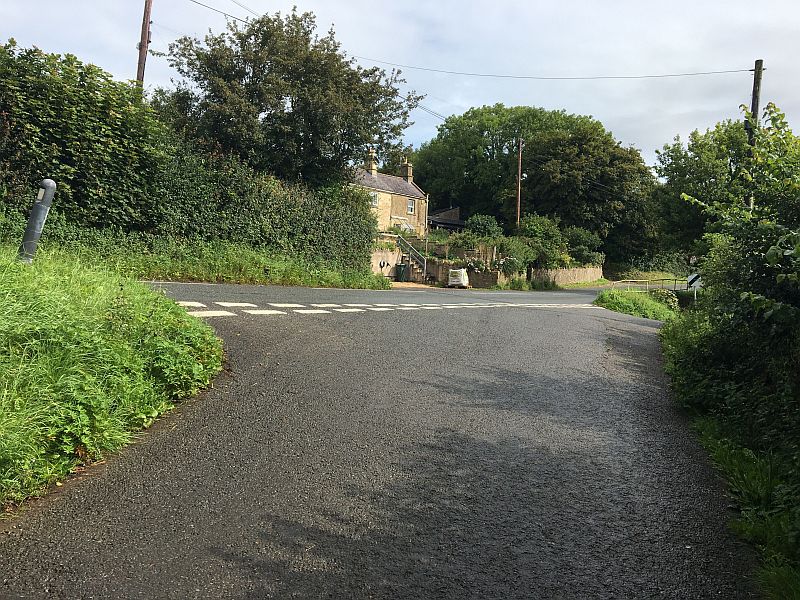
[5] Cross the road, turn right for a few yards in front of a row of cottages and at the end of them a bridleway is signposted. Turn left into the bridleway and after fifty yards or so go through a metal pedestrian gate leading into a field. Go straight forward with the hedge on your right and admire the lovely views to your left. Keep on this line with the hedge on your right through two large fields until you reach a metal bridle gate in the corner of the field. Go through, onto a dirt track, turn left and continue walking past cottages until reaching a lane and minor junction.
[6] Cross the lane and walk down the lane to reach a hamlet (Inglesbatch). Walk on until reaching a T junction. Turn left down 'dead end' lane, (Mill Lane). Just before the properties of The Spud Shed and Home Farm, turn right, passing Elm Tree Farm on your left. The track becomes rough but continue to the cow sheds/barn on the your left with a small wooden gate on the left side.
[7] Pass through and along the narrow path to a kissing gate which opens onto a field. Drop down the hill, very slightly left towards another kissing gate, go through, and then downhill following the line of the path to a footbridge over the Newton Brook.
[8] Having crossed the footbridge turn left along the field edge for a good distance until you reach a metal kissing gate on the left that leads into a small wooded area. Walk through the wood. To exit the wood go slightly uphill to the kissing gate. Go through and pass the sewage works on the left. This path becomes a track, turn right and lead to a road. Go through a wooden pedestrain gate, turn right into the village of Priston.
[9] Walk up the main street until you see the Ring O’ Bells Inn and the Village Hall on your left. Turn left along the road beyond the Village Hall passing the car park. Ignore the driveway to the right and at a T junction turn right to walk towards the Church. Walk past the Church and the lane bends to the left and then to the right. Go past the cricket ground on your left and carry on along the stoney bridle way until you reach a field gate with a newly built bridle gate at the side.

[10] Go through the gate and you can break your journey by turning left and sitting on the stone seat and admiring the view up the valley. The uneven mound next to the seat marks part of an old quarry topped by a standing stone.
[11] From the gateway that you came through continue straight forward towards a kissing gate (ignoring the stile and gate on your right). Continue forward with the hedge on your right into another field until you reach a short stone wall on your right. This wall contains some good examples of ammonites. At the end of this wall turn right over the stile until you reach a cross track. Ignore the kissing gate in front of you and turn left passing a barn on your left hand side. You pass through a hedgerow and bear left across a field aiming for the recently renovated Lammas Field Farm. Go through the gateway and follow the track to a group of cottages.
[12] At Lammas Field Cottage turn right through a kissing gate and follow the line of the hedge on your right hand side. Go through two successive Bristol gates and the hill of Farmborough Common will be on your left. Carry on the same line through a further Bristol gate to a kissing gate in the field corner. Walk along the field edge with the hedge on your right until your reach a footpath junction.

[13] Turn left at this signpost and descend the field to a wooden gate. Go through and continue with the hedge on your right. You pass through a further wooden gate before passing in front of buildings at Castle Farm, no longer a working farm. Continue with the hedge on your right to end of the field. Go through a further kissing gate leading into a large field. Keep the hedge on your right and after about 200 metres look for a kissing gate hidden in the hedge.
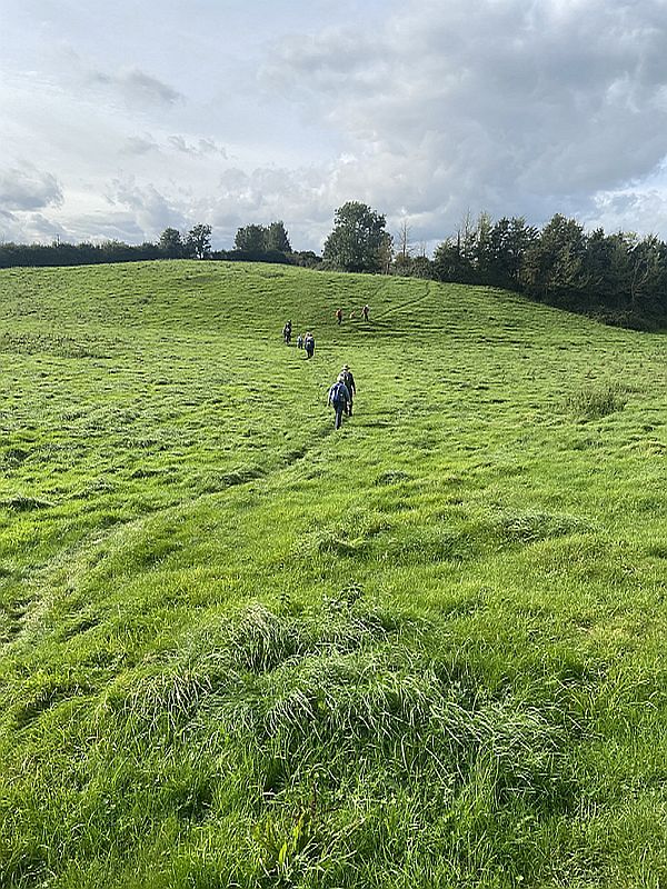
[14] Go through this and enter a short tree lined path and through a further kissing gate. Bear diagonally right across an undulating field to a kissing gate in the top corner of the field. Go through and an enclosed pathway leads you to emerge on a road opposite the Butchers Arms. If you are using public transport the village bus stops are on your right. If using your own transport cross the road and follow the road through the village. The centre of the village, with a stream running beside the road, is called The Street and many of the older houses once belonged to the Hunstrete Estate. This leg of the Radstock Ring finishes in The Street where car parking is possible in the roadside between the bottom of Church Lane and Poor Hill. Should you require parking for many cars there is a car park belonging to All Saints Church at the top of Church Lane.